


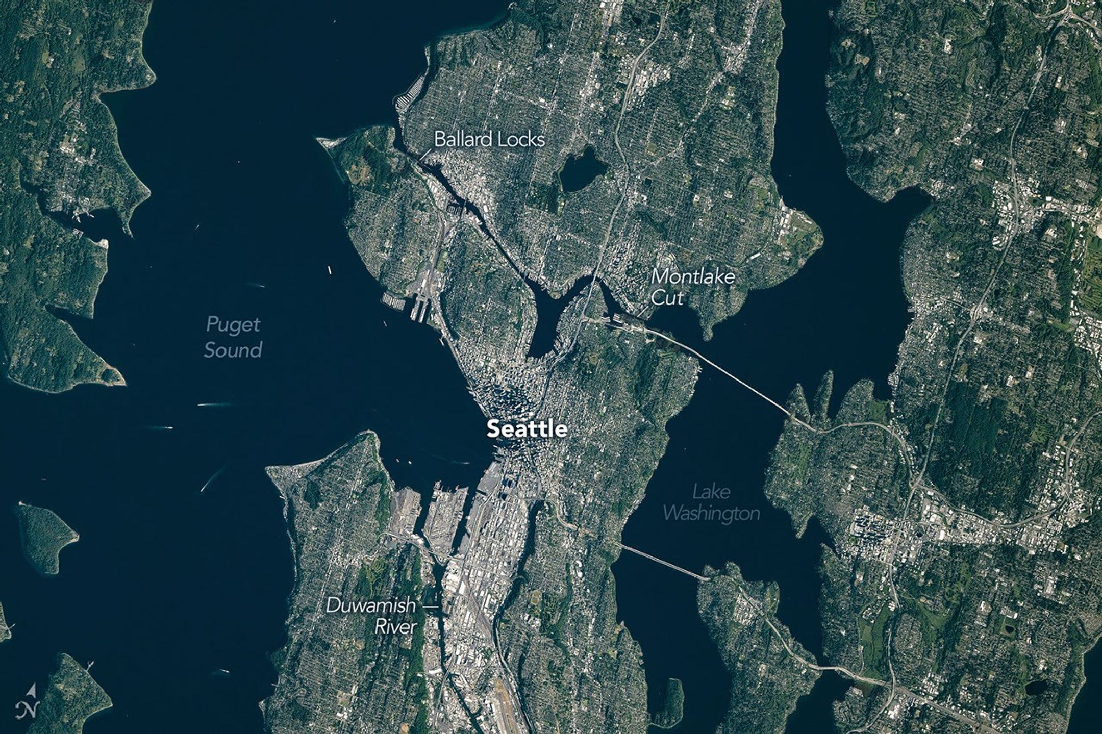
Seattle, Washington—sometimes known as the “Emerald City”—was glimmering in the morning sunlight when an astronaut aboard the International Space Station took this photo on June 16, 2026. The city’s parks and tree-filled neighborhoods lend a lush, green look to the metropolis, while tall buildings downtown cast long shadows and ships navigate surrounding waterways.The broad contours of the city’s landscape and the water around it owe their shape to the advance and retreat of glaciers during the last ice age. Between roughly 18,000 and 16,000 years ago, the Puget lobe of the Cordilleran ice sheet covered the area in a mass of ice up to 3,300 feet (1,000 meters) thick. The glacier scoured the basins now occupied by Puget Sound and the region’s lakes. The glacier left its mark above water, too. Several of Seattle’s notorious hills (of which there are seven or more, depending on who’s counting) are drumlins. These elongated mounds of glacial debris run north-south, parallel to the direction of the ice’s movement. East-west travelers in the city, facing challenging ups and downs, may attest to this topographic trend.The ice also transported large boulders called glacial erratics from more northerly locations and deposited them around the region. A particularly large erratic, the Wedgwood Rock, stands about 20 feet (6 meters) tall and draws its name from the North Seattle neighborhood in which it rests.In more recent times, humans have undertaken projects to rework the topography. Notable alterations include leveling Denny Hill north of downtown and filling in tideflats at the mouth of the Duwamish River south of downtown, which created around 1,300 acres of new land. Seattle’s professional sports stadiums sit atop this fill.This photo was acquired after several development projects to update waterfront infrastructure downtown, initiated in 2010, were completed. These include a new ferry dock and terminal, a rebuilt seawall, and a tunnel to replace an above-ground highway and create more inviting public access to the waterfront.Some replumbing of the region’s waterways is apparent from the astronaut’s perspective, as well. In the 1910s, the Army Corps of Engineers built canals on either side of Lake Union to connect Puget Sound (an inlet of the Pacific Ocean) with Lake Washington. Starting in 1916, the Montlake Cut connected Lake Washington to Lake Union, and the Ballard Locks, northwest of Lake Union, began raising and lowering watercraft between the freshwater lakes and tidal Puget Sound. As a result of this…
Lire l'article complet ici : NASA News: Shaping the Emerald City